
Geography and Geometry
Human Contours of the Topographic City
San Francisco is an island, surrounded by water on three sides and mountains on the fourth. Ambrose Bierce famously claimed ‘This city is a point upon a map of fog’. Bridges and freeways connect the island. The 49 square miles has 48 named hills which produce an intricate web of valleys. This rolling topography makes a city of visual vantage points looking up and down at itself self-consciously.
Overviews that most capture the city appear crossing the Golden Gate Bridge, when the hills with grids of stepped blocks appear all white and gleaming like some Mediterranean cubic crustacean, a cartesian mollusk covering the hills like some ancient mat, folded over the landscape. Or looking out from Twin Peaks, where the white stepped geometry encrusts the rolling California hills which burst out with forty crowns.
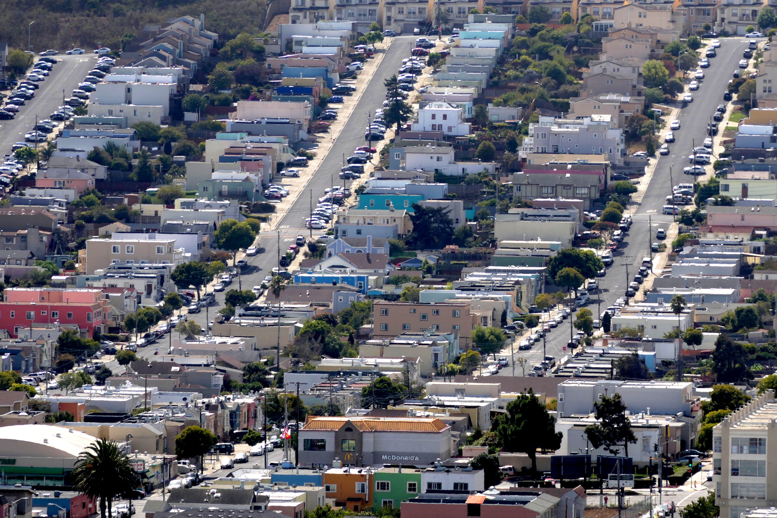
The grid dropped onto the topography has resulted in a staircase city of buildings arrayed over the hills, a congealed stepping geometry arrayed in 25’ contours which cover the slopes and descend the valleys. The fight between the essential need of flatness for habitation, and the natural slope of the land, creates this endless figure of jogging overlap between horizontal and vertical, angular and flat.
This intersection of geography and geometry is the key element of uniqueness of the city. Unlike most hill towns, contours are countered rather than complemented by marking out streets and lots that form the matt of built city as idealized geometry, until it becomes impossible. In the dual of geometry vs geography, where the angle of repose exceeds the feasibility to climb, hills dominate and the grid dissolves into wilds with winding paths and stairways. These unbuilt vantage points provide outlooks to view the interplay of made from natural.
The resulting contours of construction, the contradictions of human order and geography, are the topic of these images, and the search for an aesthetic to continue to build the city, the reason behind this search.
The human topography that defines the city appears both in broad stokes everywhere, as well as in the smallest details of the intersection of these polar realities closeup. At flat landings meeting a hill, or mailboxes anchored to the slope, or streets cresting on invisible hilltops and falling into valleys, this contradiction is always evident, this paradox of hill and horizontal juxtaposed. The gridded cartography counters the contoured geography.
Yet topography and use are also intimately interconnected over the Hills and Valleys of the city. The interplay of land and water is mirrored by the patterns of use of the inhabitants, gravity collecting at the lowest point. These low and flat areas are where the communal collecting points of the city occur.
Programmatic land use follows the principles of water, congregating in valleys which are the main gathering places. Market Street is the riverbed than runs from Twin Peaks to the Bay. Columbus Avenue is the main assembly street in the valley between Telegraph and Russian Hills. Polk Street, originally Polk gulch, is the ravine between Russian Hill and Pacific Heights. All around the flat Bayshore are gathering places for commerce and recreation, from Downtown all along the Embarcadero from South Beach to Crissy Fields.
The entire city is as an amphitheater with the bay as stage. Each hill provides a vantage point to look out at itself. So much of San Francisco’s charm emerges from this self-reflection, showing itself off to itself. Each view mirrors the view it provides, looking back at itself from behind. The stacked hills are contoured elevations of the collection of buildings that inhabit them, pictures of walls and roofs that step up and down.
This collection of images looking at the city are presented in eleven frames:


Contours

Datums

Grids

Hills

Inbetween

Profiles

Steps

Networks

Topographies

Valleys
Vertigo